Snowshoeing &
Winter Exploring
Pittsburg, NH
Snowshoeing &
Winter Exploring
in Pittsburg, NH
Snowshoes Offered
to TTL Guests!
Enjoy the peace of Pittsburg, NH's wilderness by snowshoeing with a pair of Tall Timber snowshoes this winter. Tall Timber guests have free use of our snowshoes to explore Pittsburg's backcountry. Just check with us at the front desk for information on availability during your stay.
While northern NH's network of snowmobile trails are available for cross country skiers and snowshoers, there are many great options for exploring our backcountry spots as well. If you do use a snowmobile trail, be careful, especially on weekends and the entire month of February. By the way, all forms of winter recreation are prohibited on plowed roads, including areas where there is active hauling of forest products, logging trucks, or road building equipment at work. We hope you will appreciate the privilege of enjoying these privately-built and maintained recreational areas through responsible use and respect for the property of all landowners.
The routes detailed in this guide are seldom traveled by snowmobiles and therefore may not be "broken" for use, particularly after major snowfalls. This is especially the case with the Coon Brook Bog and Big Brook Bog trails, where snowmobile use can be rare. Be prepared for vigorous exercise!
We encourage you to talk to us at the front desk at the lodge for advice on the best routes to take when skiing and snowshoeing in Pittsburg. Several of us here go out on these trails ourselves, so we can give you some good info on them.
Set your tripometer to "0" at the intersection of Beach Road and Route 3 to track mileages to skiing and snowshoeing trailheads.
Coon Brook / Unknown Pond
8.0 miles North on Route 3
Starting from the vehicle turn-out area off of Route 3 just past the road to the bog, this 1.7 mile trek is a relatively steady climb to its destination. Just prior to reaching Coon Brook Bog, the road forks. Rather than staying straight, where you will find a locked orange gate, proceed to the left and down a slight decline to the bog.
For the more adventurous at heart, the short excursion to Unknown Pond is definitely worth the trip. While this is an ideal snowshoe trek, it has been made on skis as well. However, those undertaking this journey must use a compass, as the "trail" to the pond is little more than a ribboned game trail which can be easily lost. The trail departs at approximately the halfway point from the Coon Brook Bog trail and proceeds steadily uphill. The reward for your perseverance is close at hand upon reaching the "height of the land". Since ice thicknesses are unknown, please stay off of all ponds and bogs.
Big Brook Bog
8.9 miles North on Route 3
Slightly longer in distance than Coon Brook Bog, the trip to Big Brook Bog is an easily obtainable destination point only 2.3 miles from Route 3. This trail has an easier grade to it than others in our area and it also has several secondary routes worth exploring. About halfway up the main road, a logging road climbs a steady hill to the left (there is also a gate at this fork). By proceeding uphill to the left, one can find the aforementioned Unknown Pond (see the Coon Brook Bog description) by staying on this road - a slightly easier way to find the pond than from the Coon Brook Bog side. If you want to continue past Big Brook Bog, the road forks to the right and left another .7 miles past the turn to the bog. Though both roads dead end shortly, their steep pitches on the way up provide nice observation points for the bog and the surrounding countryside on the way down.
Note: Just after the start of the logging road off of Route 3 (where you will see an orange gate that is usually kept open), there is a vehicle turn around on the right. Park here, as there is room for several vehicles.
River Road
2.7 miles North on Rte 3
to River Road.
At 4.9 miles, park at
Lk. Francis State Park
Proceed from the parking area at Lake Francis State Park on River Road, which is used for snowmobile traffic only from this point. Don’t let the opening incline intimidate you: this trail does level eventually, but it offers challenges later on. The road continues for approximately one mile before the trail splits off to the right. This trail eventually comes out in the Hill Road area of Pittsburg, 2 + miles away. The trail offers a steady climb, providing viewpoints of Lake Francis and Carr Ridge. Though the main trail forks about a mile in, both trails are well worth exploring, but make sure to follow the same trail back to the parking area. The challenge for skiers is in the descent, as they will be forced to navigate the trail’s low-lying canopied coniferous forest in addition to its winding course.
Note: The snowmobile trails inside of Lake Francis State Park are open for recreation as well, one of which follows the Connecticut River north toward First Connecticut Lake.
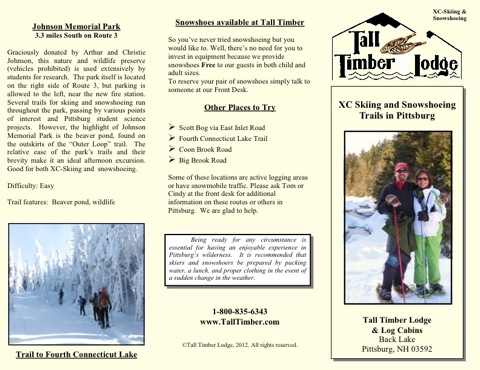
Johnson Memorial Park
3.3 miles South on Route 3
Graciously donated by Arthur and Christie Johnson, this nature and wildlife preserve (motorized vehicles prohibited) is used extensively by students for research. The park itself is located on the right side of Route 3, but parking is allowed to the left, near the town highway garage. Several trails for skiing and snowshoeing run throughout the park, passing by various points of interest and "science projects". However, the highlight of Johnson Memorial Park is the beaver pond, found on the outskirts of the "Outer Loop" trail. The relative ease of the park’s trails and their brevity make it an ideal afternoon excursion.
Please keep in mind that the availability of logging roads for use by skiers and snowshoers is completely at the discretion of the individual landowner and may change without notice.


CONTACT US
Tall Timber Lodge
& Rainbow Grille
609 Beach Rd.
Pittsburg, NH 03592
Tel: 800-835-6343 /
603-538-6651
Fax: 603-538-6582
Contact Us
©2024 Tall Timber Lodge
ACTIVITIES